Contact Us

Namibia

Fish River Canyon

Where Ancient Earth Splits Open

Location Overview

Flag of Namibia

Fish River Canyon

Where Ancient Earth Splits Open

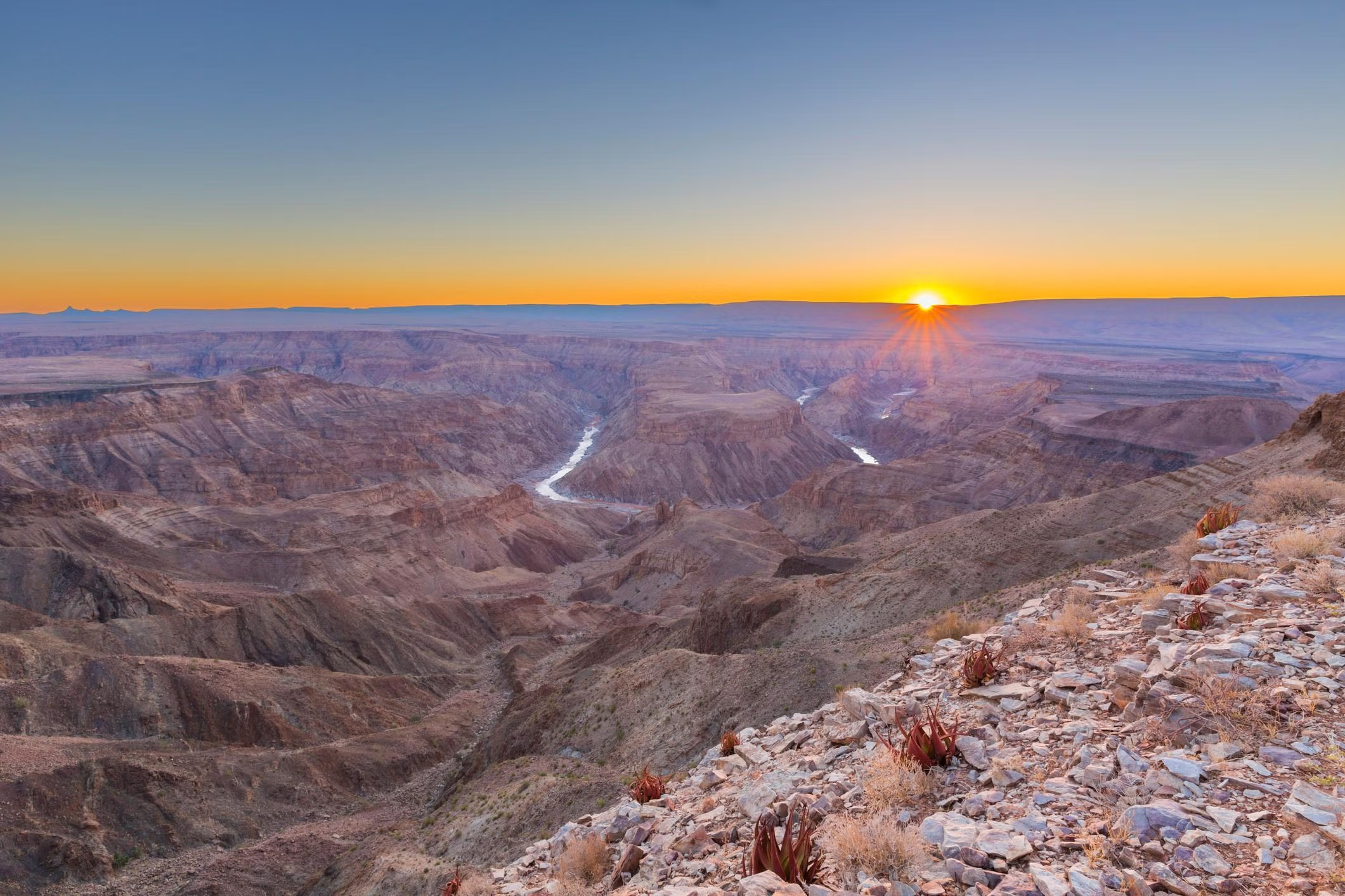
The Nama people called this place ‘ai-gams’ and understood the canyon long before European surveyors reached it in the 1830s. Stretching 160 kilometers through southern Namibia, plunging 550 meters at its deepest, and spanning 27 kilometers at its widest, the Fish River Canyon ranks as Africa’s largest canyon and the second largest on Earth. Tectonic fracturing 500 million years ago opened the initial rift, and the Dwyka glaciation 300 million years later deepened it further. Today, exposed gneiss and granite date back 1.8 billion years. Hartmann’s mountain zebra navigate the cliffs, klipspringers balance on cylindrical hooves, and at the canyon’s southern end, the thermal springs of Ai-Ais bubble from deep underground, rewarding hikers who complete the 85-kilometer trail through one of Earth’s most ancient landscapes.

Location

Fish River Canyon

-27.5843° / 17.6067°

Open in Google Maps

Bespoke Travel

Experience Fish River Canyon, Your Way

Skip the standard itineraries. We design journeys around your interests, timeline, and curiosity, with access you will not find on any platform.

100%
Customizable
24hr
Response Time
1:1
Expert Planning

Experiences

Things to Do in Fish River Canyon

Starting points for your perfect trip

Ready to create something unique?

Tell us your vision and we will make it happen

Where Ancient Earth Splits Open

A Closer Look at Fish River Canyon

A Chasm Half a Billion Years in the Making

Fish River Canyon · 01 / 03

Chapter 01 / 03

A Chasm Half a Billion Years in the Making

The Fish River Canyon stretches 160 kilometers through Namibia’s parched south, plunges 550 meters at its deepest point, and spans 27 kilometers at its widest. This is Africa’s largest canyon and the second largest on Earth after the Grand Canyon. Yet unlike its American counterpart, which receives six million visitors annually, fewer than 60,000 people make the journey here each year. Those who do find themselves alone with geology so ancient it predates complex life on Earth. The Nama people, who have lived in this region for centuries, tell of a giant serpent whose death throes carved the gorge, a creation story that speaks to the canyon’s scale and power.

The canyon’s formation began roughly 500 million years ago when tectonic forces fractured the crust into a massive north-south graben, a dropped block along which the Fish River began cutting downward. The Dwyka glaciation 300 million years ago deepened the channel further, and when Gondwana split apart 120 million years ago, the rising African continent gave the river renewed erosive power. Today, the canyon exposes layers of rock stretching back 1.8 billion years: gneiss and granite from Earth’s earliest eras, cut through by 770-million-year-old dolerite dykes that stripe the walls like dark veins. Geothermal activity along these ancient fault lines feeds the hot springs at Ai-Ais, where water emerges at 57°C from deep underground.

Contents

Plan Your Journey

Best Time to Visit Fish River Canyon

The ideal window for the Fish River Canyon trail and southern Namibia broadly. Crisp mornings around 6°C give way to comfortable 22–25°C afternoons under cloudless skies, and the 85-kilometer trail is in prime condition with manageable river crossings. Gondwana Canyon Park wildlife drives benefit from sparse vegetation that concentrates animals at water sources. July mornings at canyon depth can drop near freezing, but by midday the desert sun warms the rock walls. Peak booking demand means permits should be secured 6–12 months ahead. Pack warm layers for cold desert nights.

Annual Overview

Fish River Canyon has a hot desert climate with summer highs regularly exceeding 97°F from November through March, cool dry winters ideal for hiking from May through September, and annual rainfall of just 50–100mm falling as sporadic thunderstorms.

Month by month conditions in Fish River Canyon
Jan Off-season Feb Off-season Mar Off-season Apr Shoulder May Great Jun Peak Jul Peak Aug Peak Sep Great Oct Shoulder Nov Off-season Dec Off-season
97° 95° 94° 88° 81° 72° 72° 76° 83° 88° 95° 95°
  • Peak
  • Great
  • Good
  • Shoulder
  • Off-season

Travel Logistics

Getting to Fish River Canyon

Choose your route. Every option arrives at the same place.

Drive from Windhoek

Journey Time
7-8 hours by road
Approximate Cost
From $150-200 USD fuel costs

The most common approach covers approximately 500 kilometers south from Windhoek on the B1 highway through Mariental and Keetmanshoop, then west via the C12 and C37 gravel roads to Hobas. The route is paved until the final 70-kilometer stretch, and the drive crosses semi-arid thornveld with occasional kudu and gemsbok alongside the road.

  • Drive from Windhoek

    The most common approach covers approximately 500 kilometers south from Windhoek on the B1 highway through Mariental and Keetmanshoop, then west via the C12 and C37 gravel roads to Hobas. The route is paved…

    Approximate Cost
    From $150-200 USD fuel costs
  • Via Keetmanshoop

    From Keetmanshoop, the nearest major town 130 kilometers northeast, take the B4 west before turning south onto the C12 and C37 gravel roads toward Hobas. The final 30 kilometers to the canyon viewpoint require…

    Approximate Cost
    Included in tour packages
  • Internal Canyon Transfers

    The main sites at Hobas viewpoint in the north and Ai-Ais hot springs resort in the south are connected by 68 kilometers of gravel road winding through flat desert terrain. Namibia Wildlife Resorts operates…

    Approximate Cost
    Included in tour packages

Why Travel with Us

Travel with EcoVoyager

Fish River Canyon lies 500 kilometers south of Windhoek in Namibia’s remote |Karas Region, where the semi-arid plateau drops 550 meters into Africa’s largest gorge. EcoVoyager arranges overland transfers with experienced drivers who know the gravel roads, coordinates stays at characterful canyon-edge lodges including Gondwana Canyon Village and Fish River Lodge, and secures hiking trail permits through Namibia Wildlife Resorts months in advance. Our local partners provide naturalist-guided canyon rim walks, wildlife tracking in the 126,000-hectare Gondwana Canyon Park, and shuttles between Hobas viewpoint and Ai-Ais hot springs, turning one of Africa’s most demanding wilderness areas into a managed expedition.

  • Naturalist-guided canyon rim walks and wildlife tracking
  • Permit-secured hiking trail logistics through Namibia Wildlife Resorts
  • Lodge-coordinated canyon accommodations with sundowner experiences
  • Specialist-arranged transfers across southern Namibia's gravel roads

Keep Exploring

Other Namibia Destinations

Locations

1 / 10

Caprivi Strip

Stretching like a narrow finger 450 kilometers into southern Africa, the Caprivi Strip — now officially the Zambezi Region — defies everything you expect from Namibia. No deserts here. Five perennial rivers carve through…

Caprivi Strip in Namibia

Caprivi Strip, Namibia

Caprivi Strip

Stretching like a narrow finger 450 kilometers into southern Africa, the Caprivi Strip — now officially the Zambezi Region — defies everything you expect from Namibia. No deserts here. Five perennial rivers carve through…

Damaraland in Namibia

Damaraland, Namibia

Damaraland

In Namibia's rugged northwest lies Damaraland—a landscape of red sandstone mountains, petrified forests, and ephemeral rivers where the impossible becomes ordinary. Here, elephants survive on fog and buried water, walking 70 kilometers daily across…

Etosha National Park in Namibia

Etosha, Namibia

Etosha National Park

German colonial governor Friedrich von Lindequist proclaimed Etosha as Game Reserve No. 2 in 1907, responding to the near-extermination of elephants and rhinos by hunters and the rinderpest epidemic of the 1890s. At roughly…

Kaokoland in Namibia

Kaokoland, Namibia

Kaokoland

In Namibia's remote northwest, where the Kunene River marks the Angolan border, live the Himba — one of Africa's last truly traditional peoples. Numbering around 50,000, they inhabit Kaokoland, a 50,000-square-kilometer wilderness of mountains,…

Kolmanskop Ghost Town in Namibia

Kolmanskop, Namibia

Kolmanskop Ghost Town

Rising from the ancient Namib Desert lies Kolmanskop—a haunting testament to fortune and impermanence. In 1908, a railway worker discovered diamonds so abundant they could be plucked from the sand by moonlight. German miners…

Skeleton Coast in Namibia

Skeleton Coast, Namibia

Skeleton Coast

Portuguese sailors called this 500-kilometer Atlantic coastline ‘As Areias do Inferno’ in the 1500s, and the San people named it ‘The Land God Made in Anger.’ The name Skeleton Coast entered the global imagination…

Sossusvlei in Namibia

Sossusvlei, Namibia

Sossusvlei

The Namib has maintained arid conditions for 55 to 80 million years, making it the oldest desert on Earth, and the dunes of Sossusvlei represent its most concentrated expression. Sand carried from Africa’s interior…

Spitzkoppe in Namibia

Spitzkoppe, Namibia

Spitzkoppe

Rising 700 meters from the ancient Namib Desert floor, Spitzkoppe's granite peaks have stood sentinel for 120 million years — since before the dinosaurs vanished. German for 'pointed dome,' the main peak reaches 1,728…

Swakopmund in Namibia

Swakopmund, Namibia

Swakopmund

Captain Curt von François founded Swakopmund on August 8, 1892, raising beacons on a shore where the Namib—the world's oldest desert at 55 million years—meets the cold Benguela Current. The San and Damara peoples…

Walvis Bay Lagoon in Namibia

Walvis Bay, Namibia

Walvis Bay Lagoon

Along Namibia's Atlantic coast, the world's oldest desert surrenders to the sea, creating one of Africa's most important wetlands. The Walvis Bay Lagoon — Ramsar-protected since 1995 — spans 10,550 hectares and transforms the…