Contact Us

Namibia

Sossusvlei

Where Ancient Dunes Meet Timeless Skies

Location Overview

Flag of Namibia

Sossusvlei

Where Ancient Dunes Meet Timeless Skies

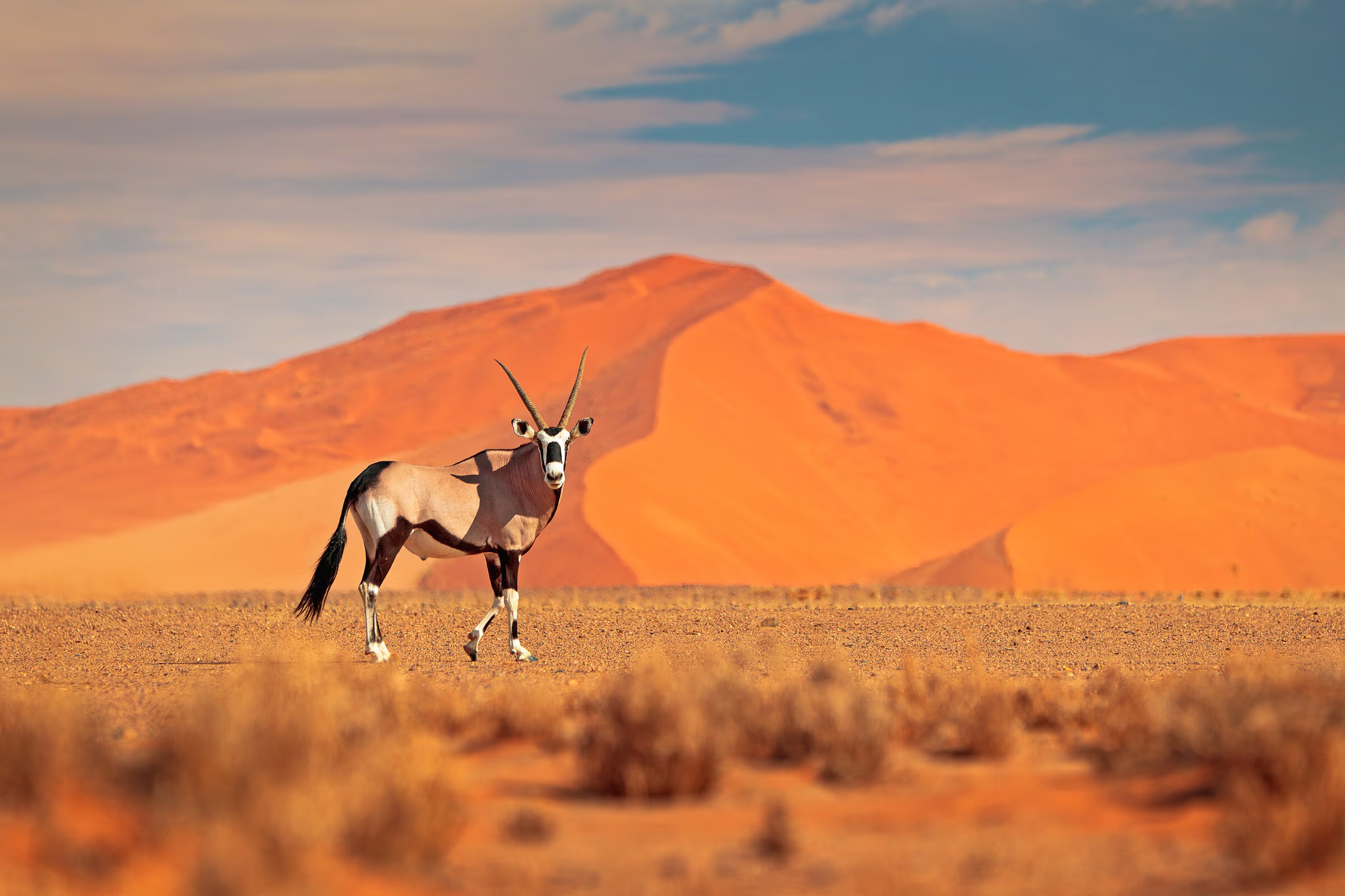
The Namib has maintained arid conditions for 55 to 80 million years, making it the oldest desert on Earth, and the dunes of Sossusvlei represent its most concentrated expression. Sand carried from Africa’s interior by the Orange River, deposited into the Atlantic, and blown back onto land by coastal winds now rises 325 meters at Big Daddy, its iron-oxide coating deepening from pink to burnt orange with age. Nine hundred years ago, the Tsauchab River still reached these clay pans, sustaining camel thorn trees that stand blackened and preserved today in hyper-arid Deadvlei. The Namib Sand Sea earned UNESCO World Heritage status in 2013, covering three million hectares where fog-basking beetles, Welwitschia plants over 1,000 years old, and gemsbok that never drink water have evolved strategies found nowhere else.

Location

Sossusvlei

-24.7275° / 15.3414°

Open in Google Maps

Bespoke Travel

Experience Sossusvlei, Your Way

Skip the standard itineraries. We design journeys around your interests, timeline, and curiosity, with access you will not find on any platform.

100%
Customizable
24hr
Response Time
1:1
Expert Planning

Experiences

Things to Do in Sossusvlei

Starting points for your perfect trip

Ready to create something unique?

Tell us your vision and we will make it happen

Where Ancient Dunes Meet Timeless Skies

A Closer Look at Sossusvlei

The World's Oldest Desert

Sossusvlei · 01 / 03

Chapter 01 / 03

The World's Oldest Desert

The Namib Desert has maintained arid conditions for 55 to 80 million years, making it the oldest desert on Earth. While other great deserts have cycled through wet and dry periods, the Namib has remained parched since before the dinosaurs went extinct, its aridity locked in by the cold Benguela Current that suppresses rainfall along the Atlantic coast. This antiquity has created one of the planet’s most specialized ecosystems, where evolution has had tens of millions of years to shape survival strategies found nowhere else, from beetles that harvest fog on their backs to plants that grow two leaves continuously for over a millennium in sand that contains no nutrients.

The dunes of Sossusvlei represent the visible heart of the Namib Sand Sea, a UNESCO World Heritage Site since 2013 covering over three million hectares. These formations began as sediments carried from Africa’s interior by the Orange River, deposited into the Atlantic, then blown back onto land by coastal winds over five million years. The distinctive red-orange color comes from iron oxide coating each grain of sand, the coating deepening with geological age so that older dunes glow a deeper burnt orange than younger formations. Some dunes here exceed 300 meters, ranking among the tallest on Earth, their star shapes sculpted by winds arriving from multiple directions throughout the year.

Contents

Plan Your Journey

Best Time to Visit Sossusvlei

The top season for Sossusvlei. Afternoon temperatures settle around 25°C with totally dry skies, though mornings can drop below 9°C and the dunes hold a chill until mid-morning. Iron-oxide colors are at their deepest in the low winter light, with long shadows stretching across the sand sea at sunrise and sunset. Gemsbok and springbok gather near pan edges where moisture lingers longest. Deadvlei’s 900-year-old trees contrast sharply against white clay under cloudless skies. Peak tourism runs June through August, and lodges with early gate access should be booked well ahead.

Annual Overview

Sossusvlei has a hot desert climate with summer highs regularly exceeding 90°F from October through March, cool dry winters with comfortable 73–77°F afternoons from June through August, and annual rainfall averaging just 55mm concentrated in brief thunderstorms.

Month by month conditions in Sossusvlei
Jan Shoulder Feb Shoulder Mar Shoulder Apr Good May Peak Jun Peak Jul Peak Aug Peak Sep Great Oct Great Nov Great Dec Shoulder
86° 84° 84° 81° 77° 73° 73° 73° 77° 79° 82° 84°
  • Peak
  • Great
  • Good
  • Shoulder
  • Off-season

Travel Logistics

Getting to Sossusvlei

Choose your route. Every option arrives at the same place.

Drive from Windhoek

Journey Time
4-5 hours by road
Approximate Cost
From $80-120 USD fuel and vehicle

The 350-kilometer journey from Windhoek crosses the highland plateau before descending toward the Namib via the Spreetshoogte Pass, where the road drops from 1,700 meters to the desert floor with views across the sand sea. The route is paved until the final gravel sections near Sesriem gate, and a standard 2WD vehicle handles the drive in dry conditions.

  • Drive from Windhoek

    The 350-kilometer journey from Windhoek crosses the highland plateau before descending toward the Namib via the Spreetshoogte Pass, where the road drops from 1,700 meters to the desert floor with views across the sand…

    Approximate Cost
    From $80-120 USD fuel and vehicle
  • Scenic Charter Flight

    Charter flights from Windhoek’s Eros Airport or Swakopmund land at Sesriem Airstrip inside the park, eliminating the five-hour drive and providing aerial views across the dune sea en route. Several operators run scheduled safari…

    Approximate Cost
    From $300-500 USD per person
  • Internal Park Transfers

    From Sesriem gate, a 65-kilometer tarred road leads to the Sossusvlei parking area where the road surface ends. The final 5 kilometers to Deadvlei require 4x4 or the park shuttle, which runs from the…

    Approximate Cost
    Included in tour packages

Why Travel with Us

Travel with EcoVoyager

Sossusvlei sits 350 kilometers from Windhoek inside the Namib-Naukluft National Park, with Sesriem gate controlling access to the 65-kilometer road that ends at the dune vleis. EcoVoyager arranges charter flights landing at Sesriem Airstrip, coordinates 4x4 transfers through the deep sand section to Deadvlei, and secures stays at lodges like Sossusvlei Lodge, Kulala Desert Lodge, and Little Kulala that provide exclusive early gate access before sunrise. Our local guides lead summit climbs on Big Daddy and Dune 45, balloon flights over the sand sea, Sesriem Canyon walks, and night-sky sessions in Africa’s only International Dark Sky Reserve.

  • Naturalist-guided dune summit climbs and desert ecology walks
  • Pre-sunrise gate access through exclusive lodge partnerships
  • Safari-connected charter flights linking Sossusvlei to Etosha
  • Astronomer-led stargazing sessions in the NamibRand Dark Sky Reserve

Keep Exploring

Other Namibia Destinations

Locations

1 / 10

Caprivi Strip

Stretching like a narrow finger 450 kilometers into southern Africa, the Caprivi Strip — now officially the Zambezi Region — defies everything you expect from Namibia. No deserts here. Five perennial rivers carve through…

Caprivi Strip in Namibia

Caprivi Strip, Namibia

Caprivi Strip

Stretching like a narrow finger 450 kilometers into southern Africa, the Caprivi Strip — now officially the Zambezi Region — defies everything you expect from Namibia. No deserts here. Five perennial rivers carve through…

Damaraland in Namibia

Damaraland, Namibia

Damaraland

In Namibia's rugged northwest lies Damaraland—a landscape of red sandstone mountains, petrified forests, and ephemeral rivers where the impossible becomes ordinary. Here, elephants survive on fog and buried water, walking 70 kilometers daily across…

Etosha National Park in Namibia

Etosha, Namibia

Etosha National Park

German colonial governor Friedrich von Lindequist proclaimed Etosha as Game Reserve No. 2 in 1907, responding to the near-extermination of elephants and rhinos by hunters and the rinderpest epidemic of the 1890s. At roughly…

Fish River Canyon in Namibia

Fish River Canyon, Namibia

Fish River Canyon

The Nama people called this place ‘ai-gams’ and understood the canyon long before European surveyors reached it in the 1830s. Stretching 160 kilometers through southern Namibia, plunging 550 meters at its deepest, and spanning…

Kaokoland in Namibia

Kaokoland, Namibia

Kaokoland

In Namibia's remote northwest, where the Kunene River marks the Angolan border, live the Himba — one of Africa's last truly traditional peoples. Numbering around 50,000, they inhabit Kaokoland, a 50,000-square-kilometer wilderness of mountains,…

Kolmanskop Ghost Town in Namibia

Kolmanskop, Namibia

Kolmanskop Ghost Town

Rising from the ancient Namib Desert lies Kolmanskop—a haunting testament to fortune and impermanence. In 1908, a railway worker discovered diamonds so abundant they could be plucked from the sand by moonlight. German miners…

Skeleton Coast in Namibia

Skeleton Coast, Namibia

Skeleton Coast

Portuguese sailors called this 500-kilometer Atlantic coastline ‘As Areias do Inferno’ in the 1500s, and the San people named it ‘The Land God Made in Anger.’ The name Skeleton Coast entered the global imagination…

Spitzkoppe in Namibia

Spitzkoppe, Namibia

Spitzkoppe

Rising 700 meters from the ancient Namib Desert floor, Spitzkoppe's granite peaks have stood sentinel for 120 million years — since before the dinosaurs vanished. German for 'pointed dome,' the main peak reaches 1,728…

Swakopmund in Namibia

Swakopmund, Namibia

Swakopmund

Captain Curt von François founded Swakopmund on August 8, 1892, raising beacons on a shore where the Namib—the world's oldest desert at 55 million years—meets the cold Benguela Current. The San and Damara peoples…

Walvis Bay Lagoon in Namibia

Walvis Bay, Namibia

Walvis Bay Lagoon

Along Namibia's Atlantic coast, the world's oldest desert surrenders to the sea, creating one of Africa's most important wetlands. The Walvis Bay Lagoon — Ramsar-protected since 1995 — spans 10,550 hectares and transforms the…