


Travel to Iskanderkul Lake
A Turquoise Lake in the Fann Mountains
Iskanderkul Lake
A Turquoise Lake in the Fann Mountains
Experience Iskanderkul Lake, Your Way
Skip the standard itineraries. We design journeys around your interests, timeline, and curiosity with exclusive access you won't find on any platform.


Things to Do in Iskanderkul Lake
Starting points for your perfect trip
Fann Niagara Waterfall
Walk 20 minutes from the lakeshore to stand on a metal platform above a 43-meter waterfall plunging into a narrow gorge. The ochre and purple rock formations below have been sculpted by centuries of glacial meltwater through limestone.
Lake Trek
Circle the lake on a 19-kilometer trail with 450 meters of elevation gain over eight hours. Pass the Five Springs with reputed healing properties, cross footbridges above turquoise inlets, and watch the water shift color all day.
Snake Lake Viewpoint Hike
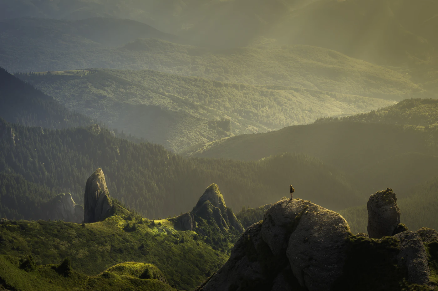
Climb the hill between Iskanderkul and Snake Lake for a split panorama: turquoise glacial water on one side and dark green reeds on the other. The trail passes a sacred juniper tree hung with colorful ribbons and fabric prayer strips.

Fann Mountains Gateway Trek
Use Iskanderkul as the start or finish of multi-day Fann Mountains treks. Routes connect over passes at 3,800 to 4,750 meters to the turquoise Alauddin and Kulikalon lake basins, where nine peaks above 5,000 meters ring the horizon.
Design Your Custom Trip
Tell us about your dream adventure. Our travel specialists respond within 24 hours with a personalised itinerary.
Alexander's Lake at 2,195 Meters
A Closer Look at Iskanderkul Lake
A Rockslide Lake in the Hissar Range
Iskanderkul sits at 2,195 meters on the northern slopes of the Hissar Range in Ayni District, Sughd Province. The lake covers 3.4 square kilometers with a maximum depth of 72 meters, formed when a massive rockslide of roughly one cubic kilometer blocked the Iskanderdarya River during the Middle Holocene. Three rivers feed the lake while a single outlet flows north to join the Fan Darya and eventually the historic Zeravshan River.
The turquoise color comes from glacial flour, ultra-fine rock particles ground by glaciers and suspended in the meltwater. Surrounding limestone contributes dissolved calcium carbonate that enhances clarity while iron oxide in the folded rock creates vivid rust-red slopes framing the water. A 300 square kilometer nature reserve protects the lake and its surrounding juniper forests, alpine meadows, and wildlife.
Alexander's Legend and Sogdian Roots
The lake is named for Alexander the Great, whose brutal Sogdian campaign of 329 to 327 BC brought his forces to the Zeravshan Valley just decades before the Iskanderdarya’s waters began filling this basin. Local legend tells of his horse Bucephalus drowning in the icy depths, and on full moon nights a spectral white horse still appears to graze on the shores. The connection is legend rather than documented history, though his campaign did pass through the wider region.
Russian naturalist Alexei Fedchenko reached the lake in 1870, leaving an inscription still visible on the rocks. Soviet development brought the Turbaza lodge and organized tourism. Nearby Ancient Panjakent, the Pompeii of Central Asia with its 5th century Sogdian ruins, and Sarazm, Tajikistan’s first UNESCO World Heritage Site, provide deeper archaeological context.
Waterfalls, Trails, and Starlit Nights
The 43-meter Fann Niagara waterfall is a 20-minute walk from the lake, viewed from a metal platform built directly over the gorge. The 19-kilometer lake circumnavigation takes roughly eight hours and passes the Five Springs and the presidential dacha on the southern shore. A climb to Dozhdemernaya peak at 3,342 meters delivers a full panorama of the lake and surrounding Fann Mountains.
Accommodation ranges from the Soviet-era Turbaza on the northern shore to homestays in Sarytag village seven kilometers away. Visitors should bring all cash needed as there are no ATMs, no WiFi, and limited phone signal. The lake is reachable from Dushanbe in three to four hours by 4×4 through the Anzob Tunnel. No special permits are required and the best months are July through September.
Explore More
Other Tajikistan Destinations
Explore more destinations across Tajikistan.
Dushanbe
Dushanbe is Tajikistan's capital and the starting point for almost every journey into the country's mountains. Set at around 800...
ExplorePamir Highway
The Pamir Highway is a 1,250-kilometer Soviet-era road crossing the Roof of the World from Dushanbe to Osh. The M41...
ExploreWakhan Valley
The Tajik Wakhan is a corridor of ancient fortresses, sacred hot springs, and living Silk Road culture, pressed against the...
ExploreFann Mountains
The Fann Mountains pack roughly 40 turquoise lakes, nearly 100 peaks, and scores of glaciers into a compact range where...
ExploreYagnob Valley
The Yagnob Valley shelters the last villages where a living descendant of Sogdian is still spoken. This 60-kilometer canyon between...
ExploreKarakul Lake
Karakul Lake fills a 52-kilometer meteorite impact crater at 3,960 meters on the Eastern Pamir plateau. This 380 square kilometer...
ExploreMurghab
At 3,618 meters on the Eastern Pamir plateau, Murghab is the highest town in Tajikistan and one of the most...
ExploreKhorog
At the confluence of the Gunt and Panj rivers, with Afghanistan visible across the water, Khorog is the only city...
ExplorePanj River Valley
For over 1,000 kilometers, the Panj River draws the line between Tajikistan and Afghanistan, sometimes just 20 meters of turquoise...
ExploreBartang Valley
Branching north off the Pamir Highway at Rushan, the Bartang is one of the wildest and least-visited valleys in the...
ExploreFedchenko Glacier
Fedchenko Glacier, renamed the Vanj-Yakh Glacier in 2023, is the longest glacier on Earth outside the polar regions, a 77-kilometer...
ExploreSarez Lake
Deep in Tajikistan's Pamir Mountains lies Sarez Lake, held in place by the highest dam on Earth. On a February...
ExploreHisor Fortress
Just 26 kilometers west of Dushanbe, Hisor Fortress is Tajikistan's most popular day trip from the capital and, for centuries,...
ExploreKulob
Wedged between the Afghan frontier and the Pamir foothills, Kulob is one of Central Asia's oldest cities, officially marking 2,700...
Explore