


Travel to Eduardo Avaroa Andean Fauna National Reserve
Flamingo Lagoons and Volcanic Deserts on Bolivia's Southern Altiplano
Eduardo Avaroa Andean Fauna National Reserve
Flamingo Lagoons and Volcanic Deserts on Bolivia's Southern Altiplano
Ecovoyager Experiences
Eduardo Avaroa Andean Fauna National Reserve Tours
Handcrafted expeditions into the remote corners of Eduardo Avaroa Andean Fauna National Reserve, led by local experts, designed for the curious traveller.


Experience Eduardo Avaroa Andean Fauna National Reserve, Your Way
Skip the standard itineraries. We design journeys around your interests, timeline, and curiosity with exclusive access you won't find on any platform.


Things to Do in Eduardo Avaroa Andean Fauna National Reserve
Starting points for your perfect trip
Sunrise over Flamingo Lagoons
Watch thousands of flamingos feed on the blood-red waters of Laguna Colorada at first light. Three of the world's six flamingo species gather here, including the James's flamingo, once thought extinct, their pink forms set against the lake's white borax islands and the volcanic peaks beyond.
Explore Sol de Mañana Volcanic Fields
Walk among bubbling mud pools and hissing fumaroles at Sol de Mañana, one of the highest geothermal fields on Earth at around 4,900 meters. Steam vents rise against the thin air and sulfurous vapor drifts from the ground, fed by a vast reservoir of heat that reaches some 250 degrees Celsius far below the surface.
Soak in Volcanic Hot Springs
Soak in the mineral-rich waters of the Termas de Polques at around 4,400 meters, where the springs hold steady near 29 degrees Celsius against the freezing altiplano air. Flamingos wade in the lagoon alongside the pools while the perfect cone of Licancabur volcano rises on the horizon.
Salvador Dalí Desert Expedition
Explore the Salvador Dalí Desert, a barren plain named for the way its wind-sculpted rocks and rust-colored sands recall the artist's surreal paintings, though he never set foot here. Stop at the Árbol de Piedra, a slender stone tree some seven meters tall carved by centuries of wind, and wander formations that seem lifted from a dream.
Design Your Custom Trip
Tell us about your dream adventure. Our travel specialists respond within 24 hours with a personalised itinerary.
Where Flamingos Dance on Blood-Red Waters
A Closer Look at Eduardo Avaroa Andean Fauna National Reserve
A Landscape Beyond Imagination
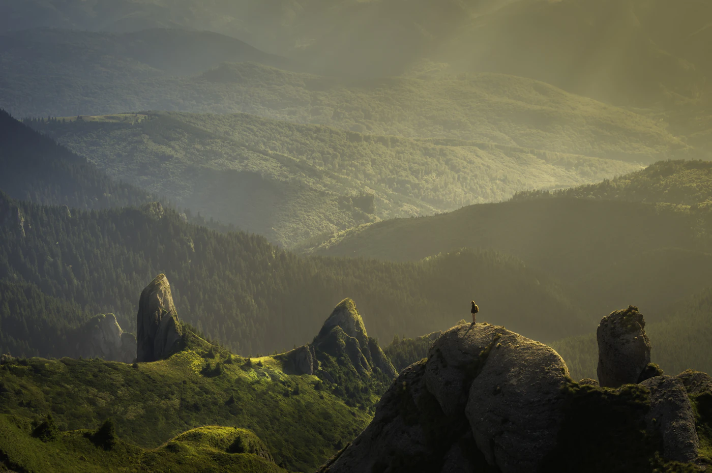
In Bolivia’s extreme southwestern corner, where the country meets Chile and Argentina, lies a protected wilderness so otherworldly that visitors often describe it as another planet. The Eduardo Avaroa Andean Fauna National Reserve, established in 1973 and named after a hero of Bolivia’s War of the Pacific, covers 714,745 hectares of high-altitude desert, volcanic peaks, and mineral-stained lagoons at elevations between 4,200 and 5,400 meters. This is the altiplano at its most dramatic, a cold, wind-swept expanse where nights regularly fall below minus 10 degrees Celsius, with extremes near minus 20, days are bright but cool, and rainfall barely reaches 76 millimeters a year.
The reserve’s centerpiece is Laguna Colorada, a shallow salt lake that glows crimson from pigmented algae and rich mineral sediments. Spanning about 60 square kilometers but rarely more than 80 centimeters deep, its blood-red waters are dotted with white islands of borax that create an almost impossible contrast. In 1990 the lake was designated a Ramsar Wetland of International Importance, recognition of its role as one of the most critical flamingo habitats on Earth. Here three of the world’s six flamingo species gather in colonies numbering tens of thousands, their pink forms mirrored in waters that seem borrowed from a dream.
The Flamingos That Returned From Extinction
The James’s flamingo, also called the puna flamingo, holds a remarkable place in ornithological history. First described in 1886 and named for the British naturalist Harry Berkeley James, this small, pale-pink bird with bright carmine streaks seemingly vanished from scientific observation in the early twentieth century. For decades researchers presumed the species extinct, another casualty of the remote and unforgiving altiplano. Then, in 1956 and 1957, an expedition led by A. W. Johnson reached Laguna Colorada and made an astonishing discovery: thousands of James’s flamingos nesting among their Chilean and Andean cousins in the red waters of this volcanic basin.
Today, nearly one-third of the entire world population of James’s flamingos, estimated at more than 100,000 birds, breeds at Laguna Colorada alone. They share the reserve with the Andean flamingo, the rarest of the world’s flamingos with only around 38,000 to 39,000 left, and the more common Chilean flamingo. All three filter-feed on the diatoms and algae that thrive in these saline waters, their specialized bills straining microscopic food from the mineral-rich lakes. The birds’ pink color comes directly from that diet, the same pigments in the algae that redden the lake also tinting their feathers. Watching thousands take flight against the snow-capped volcanoes is one of South America’s great wildlife spectacles.
Fire and Ice at the Edge of the World
South of Laguna Colorada the landscape turns volcanic. Sol de Mañana, meaning morning sun, is a geothermal field of around 10 square kilometers at 4,900 meters, one of the highest on Earth. Fumaroles hiss sulfurous steam, mud pools bubble and churn, and columns of vapor rise against the thin mountain air. The heat comes from far below, where the underground reservoir reaches some 250 degrees Celsius, part of the vast Altiplano-Puna Magma Body that underlies this corner of the Andes. Visitors walk carefully between the vents, as the thin crust has no barriers and the ground is genuinely dangerous in places.
The reserve’s southwestern edge delivers its final flourish: Laguna Verde, an emerald lake at around 4,310 meters whose intense color comes from suspended arsenic, copper, and other minerals. Unlike its red sister to the north, this lake is too toxic for flamingos, but its turquoise-to-emerald hues shift with the wind beneath the near-perfect cone of Licancabur. Rising to 5,916 meters on the Bolivia and Chile border, this stratovolcano holds one of the highest crater lakes on Earth at its summit, along with Inca ruins on its rim. The mountain was sacred to the Inca, and watching its reflection shimmer in the green water, it is easy to see why.
Explore More
Other Bolivia Destinations
Explore more destinations across Bolivia.
Barba Azul Nature Reserve
In the heart of Bolivia's Beni savanna, the Barba Azul Nature Reserve protects 12,200 hectares of seasonally flooded grassland, palm...
ExploreTarija Wine Country
In the far south of Bolivia, near the Argentine border, the city of Tarija and the surrounding valleys form the...
ExploreNoel Kempff Mercado
Spread across 1,523,446 hectares of remote northeastern Bolivia along the Brazilian border, Noel Kempff Mercado is one of South America's...
ExploreKaa-Iya National Park
Larger than Belgium and home to one of the largest jaguar populations in South America, Kaa-Iya del Gran Chaco is...
ExploreSanta Cruz de la Sierra
In Bolivia's tropical lowlands, where the Andes tumble into the Amazon, Santa Cruz opens doors to landscapes found nowhere else...
ExploreAmboro National Park
At the Elbow of the Andes, where the mountains bend westward toward Peru, Amboró National Park sits at one of...
ExploreSamaipata
Around 300 CE, peoples of the Mojocoyas culture, later associated with the Chané, began sculpting a 220-meter sandstone monolith with...
ExploreSucre
Founded in 1538 as Ciudad de la Plata by Spanish colonists profiting from nearby Potosí's silver mines, Sucre grew into...
ExplorePotosí
In 1545, an indigenous prospector named Diego Huallpa found silver on a mountain the Inca had long held sacred. Within...
ExploreMadidi National Park
Identified by Wildlife Conservation Society researchers as probably the most biodiverse protected area on Earth, Madidi spans nearly 19,000 square...
ExploreNorth Yungas Road
Carved into sheer cliffs in the 1930s, the North Yungas Road, El Camino de la Muerte, is estimated to have...
ExploreLake Titicaca
At 3,812 meters, Lake Titicaca stretches across the Andean altiplano like a shimmering inland sea, the highest navigable lake in...
ExploreSalar de Uyuni
At 3,656 meters on the Bolivian Altiplano lies the world's largest salt flat, a 10,582-square-kilometer expanse of crystalline white that...
ExploreLa Paz
Perched between 3,250 and 4,100 meters above sea level, La Paz defies gravity and expectations as the world's highest administrative...
Explore