


Travel to Kaa-Iya National Park
Bolivia's Largest National Park, in the Heart of the Gran Chaco
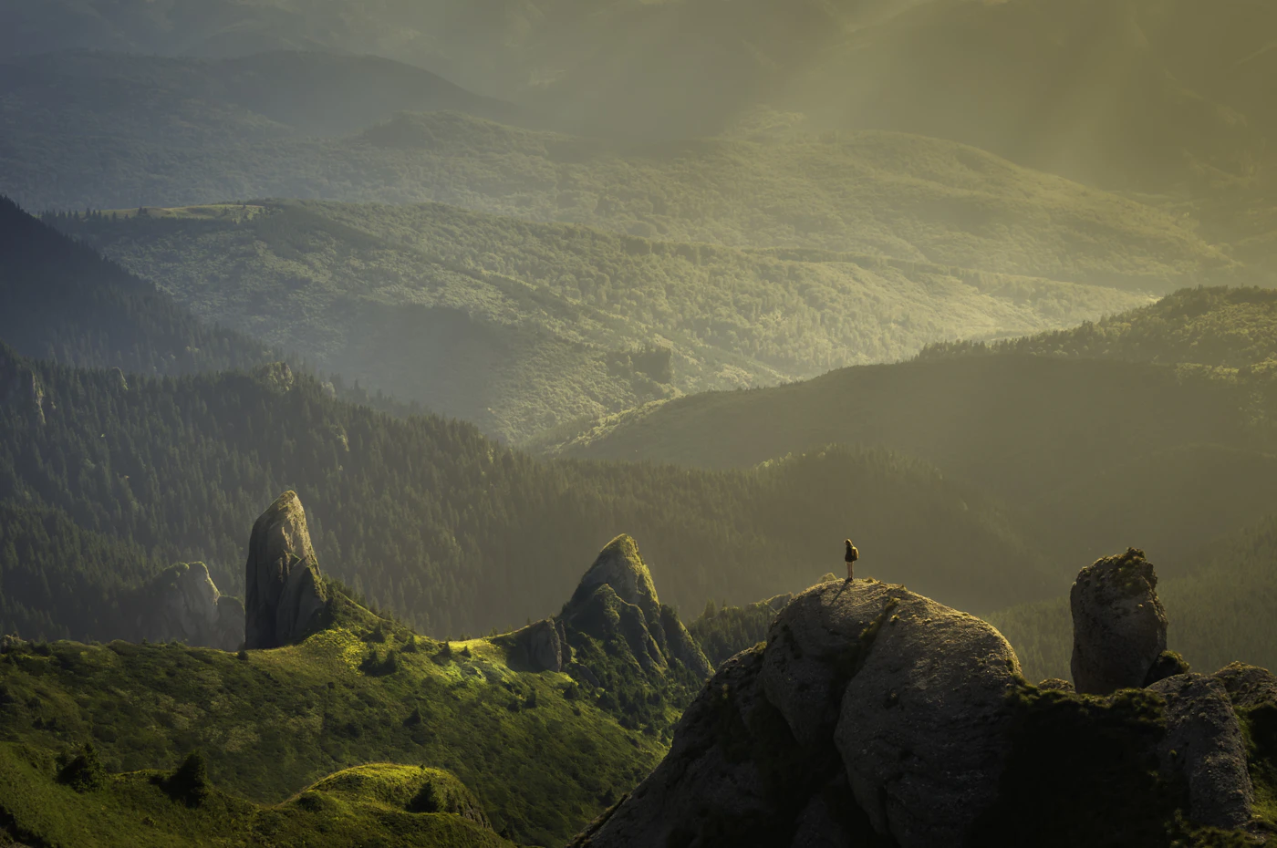
Kaa-Iya National Park
Bolivia's Largest National Park, in the Heart of the Gran Chaco

Ecovoyager Experiences
Kaa-Iya National Park Tours
Handcrafted expeditions into the remote corners of Kaa-Iya National Park, led by local experts, designed for the curious traveller.

Experience Kaa-Iya National Park, Your Way
Skip the standard itineraries. We design journeys around your interests, timeline, and curiosity with exclusive access you won't find on any platform.


Things to Do in Kaa-Iya National Park
Starting points for your perfect trip
Jaguar Tracking on the Pipeline Road
Slow 4x4 drives at dawn and dusk along the dirt corridor linking Tucavaca to the Izozog pump station, where camera-trap studies have recorded one of the largest jaguar populations documented in any protected area. Your guide reads fresh tracks and the alarm calls that give away a cat's position.
Searching for the Chacoan Peccary
The endemic tagua was known only from Pleistocene fossils until living bands were confirmed in 1975. In the alluvial Chaco around Cerro Cortado, your guide scans for characteristic wallows, cactus feeding signs, and groups of five to ten animals browsing quebracho thickets at first light.
Night Drives Through the Thorn Forest
After sunset, Tucavaca's spotlight drives crawl at walking pace through tunnels of quebracho and candelabra cactus. Beams reveal giant armadillos, Geoffroy's cat, crab-eating fox, night monkeys, and the occasional maned wolf crossing sandy tracks that held jaguar prints an hour earlier.
Waterhole Vigils at Peak Dry Season
As September advances, shrinking water sources concentrate wildlife into narrow windows of activity. From blinds and vehicles positioned at known lagoons, watch tapir, white-lipped peccary herds, giant anteater, and puma converge on the last drinking points before the rains return.
Guaraní-Isoseño Communities of the Parapetí
In the Isoso villages along the Río Parapetí, meet elders, parabiólogos trained as community field biologists, and the women's cooperatives producing algarrobo flour and native honey. Arranged through the co-management authority, these visits show the governance model that built the park.
Dark-Sky Nights at Tucavaca Camp
With no town or electric light for miles in any direction, Kaa-Iya delivers some of South America's darkest night skies. The Milky Way, the Magellanic Clouds, and the Southern Cross burn crisp above silhouetted quebracho trees while nightjars call from the thorn scrub.
Design Your Custom Trip
Tell us about your dream adventure. Our travel specialists respond within 24 hours with a personalised itinerary.
Bolivia's Wildest Dry Forest and Jaguar Stronghold
A Closer Look at Kaa-Iya National Park
The Largest Park in Bolivia's Gran Chaco
Covering 34,411 square kilometers of southeastern Santa Cruz Department, Kaa-Iya del Gran Chaco is Bolivia’s largest national park and the single biggest protected area anywhere in the Gran Chaco ecoregion, which spans four South American countries. The terrain is almost entirely flat alluvial plain, ranging from around 100 meters above sea level up to about 839 meters at its highest point, Cerro San Miguel, and transitions through four distinct Chaco landscapes: riverine forest along the Río Parapetí, the dense thorn forest of the alluvial Chaco, a transitional zone of semi-humid woodland, and the Chaco-Chiquitano transition forest along the northern edge.
The park also encloses Ramsar-listed wetlands. The Bañados del Isoso, a seasonal marsh covering more than 615,000 hectares, is fed by the Río Parapetí, which sinks underground during the dry season before its waters migrate slowly north toward the Amazon basin. Palmar de las Islas and the Salinas de San José add gleaming salt flats to the landscape. Together with the neighboring Otuquis National Park, the Ñembi Guasu indigenous conservation area, and Paraguay’s Defensores del Chaco across the border, Kaa-Iya anchors one of the largest intact dry-forest corridors remaining in the tropics.
A Stronghold for South America's Biggest Cat
The landmark 2004 camera-trap study by Maffei, Cuéllar, and Noss documented jaguar densities in the park’s Cerro Cortado sector exceeding five individuals per hundred square kilometers, among the higher densities then on record for the species. Extrapolated across Kaa-Iya’s 34,000 square kilometers, this suggested a population of more than a thousand jaguars, which the authors described as the largest single jaguar population reported anywhere at the time. Follow-up work by the Wildlife Conservation Society has tracked puma, ocelot, lowland tapir, giant armadillo, and the endemic Chacoan peccary at comparable depth.
The park’s 301 documented bird species include greater rhea, bare-faced curassow, the endangered Chaco eagle, red-legged seriema, and the endemic quebracho crested tinamou. Chaco endemic mammals are the real draw: the Chacoan peccary, rediscovered alive only in 1975 after being known solely from Pleistocene fossils; the Chacoan guanaco, whose sole protected Bolivian population of roughly 200 animals lives in Kaa-Iya’s southwestern paleodunes; and the Chacoan fairy armadillo, naked-tailed armadillo, and three-banded armadillo, all specialists of the thorn scrub.
Owners of the Forest: Indigenous Co-Management
Kaa-Iya means ‘Owners of the Forest’ in Izoceño Guaraní, referring to the spirit guardians whose permission traditional Isoseño hunters seek before taking game. The name reflects the park’s founding story. In 1995, the Capitanía del Alto y Bajo Izozog, representing roughly ten thousand Guaraní-Isoseño living in twenty-three villages along the Parapetí, partnered with the Wildlife Conservation Society to propose and then co-administer the national park. The co-management agreement signed that November was the first of its kind in South America, a template for indigenous-led conservation that later inspired similar arrangements across the continent.
The park also protects territory of the Ayoreo, whose Totobiegosode clans include the last uncontacted peoples in South America outside the Amazon basin, and Chiquitano communities along the northern boundary near San José de Chiquitos. Isoseño parabiólogos, community field biologists trained through the WCS partnership, conducted much of the foundational wildlife research in the park and continue to monitor subsistence hunting across 23 villages. The Kaa-Iya Foundation, established in 2003 with funding from the Bolivia-Brazil gas pipeline that bisects the park, provides long-term financing for ranger patrols and community conservation programs.
Explore More
Other Bolivia Destinations
Explore more destinations across Bolivia.
Barba Azul Nature Reserve
In the heart of Bolivia's Beni savanna, the Barba Azul Nature Reserve protects 12,200 hectares of seasonally flooded grassland, palm...
ExploreTarija Wine Country
In the far south of Bolivia, near the Argentine border, the city of Tarija and the surrounding valleys form the...
ExploreNoel Kempff Mercado
Spread across 1,523,446 hectares of remote northeastern Bolivia along the Brazilian border, Noel Kempff Mercado is one of South America's...
ExploreEduardo Avaroa Andean Fauna National Reserve
On Bolivia's altiplano above 4,200 meters, in the country's far southwestern corner where it meets Chile and Argentina, lies one...
ExploreSanta Cruz de la Sierra
In Bolivia's tropical lowlands, where the Andes tumble into the Amazon, Santa Cruz opens doors to landscapes found nowhere else...
ExploreAmboro National Park
At the Elbow of the Andes, where the mountains bend westward toward Peru, Amboró National Park sits at one of...
ExploreSamaipata
Around 300 CE, peoples of the Mojocoyas culture, later associated with the Chané, began sculpting a 220-meter sandstone monolith with...
ExploreSucre
Founded in 1538 as Ciudad de la Plata by Spanish colonists profiting from nearby Potosí's silver mines, Sucre grew into...
ExplorePotosí
In 1545, an indigenous prospector named Diego Huallpa found silver on a mountain the Inca had long held sacred. Within...
ExploreMadidi National Park
Identified by Wildlife Conservation Society researchers as probably the most biodiverse protected area on Earth, Madidi spans nearly 19,000 square...
ExploreNorth Yungas Road
Carved into sheer cliffs in the 1930s, the North Yungas Road, El Camino de la Muerte, is estimated to have...
ExploreLake Titicaca
At 3,812 meters, Lake Titicaca stretches across the Andean altiplano like a shimmering inland sea, the highest navigable lake in...
ExploreSalar de Uyuni
At 3,656 meters on the Bolivian Altiplano lies the world's largest salt flat, a 10,582-square-kilometer expanse of crystalline white that...
ExploreLa Paz
Perched between 3,250 and 4,100 meters above sea level, La Paz defies gravity and expectations as the world's highest administrative...
Explore