


Travel to Potosí
The Mountain That Built Empires
Potosí
The Mountain That Built Empires
Experience Potosí, Your Way
Skip the standard itineraries. We design journeys around your interests, timeline, and curiosity with exclusive access you won't find on any platform.

Things to Do in Potosí
Starting points for your perfect trip
Cerro Rico: Into the Mountain That Eats Men
Descend into active mining tunnels where cooperative miners still extract tin and zinc using centuries-old methods, navigating narrow passages past ore carts and mineral dust. Encounter shrines to El Tío, the devil-like lord of the underworld, with offerings of coca, cigarettes, and pure alcohol.
Casa de la Moneda: The Royal Mint of the Americas
Explore the fortress-like colonial mint occupying a full city block, built to turn Cerro Rico's silver into Spanish coin. See the mule-powered cog machines, colonial paintings by the master Melchor Pérez de Holguín, and the enigmatic mascarón, a grinning stone face no historian has explained.
San Lorenzo & the Mestizo Baroque Trail
Walk cobblestone streets to San Lorenzo de Carangas, where indigenous artisans carved mermaids, pumas, and celestial symbols alongside Christian imagery on an elaborate stone portal. Explore mansions blending European and Andean design, then climb the Cathedral tower for sunset views of Cerro Rico.

Sacred Waters of Tarapaya: The Inca's Eye
Journey northwest to a volcanic crater lake where the Inca emperor Huayna Capac is said to have bathed. The near-perfectly circular Ojo del Inca lies at around 3,600 meters, sacred since pre-Columbian times and believed to hold curative powers, though hidden whirlpools mean swimming in the crater is no longer allowed. The safe, restorative warmth is found in the thermal pools alongside it.

Kari Kari Lagoons
Hike to a system of colonial reservoirs built by thousands of laborers to drive the water-powered mills that ground Potosí's silver ore. The lakes sit between 4,500 and 5,025 meters amid sparse Andean flora, with sweeping views to Cerro Rico. Largely abandoned now, they still reveal the immense scale of the silver operation.
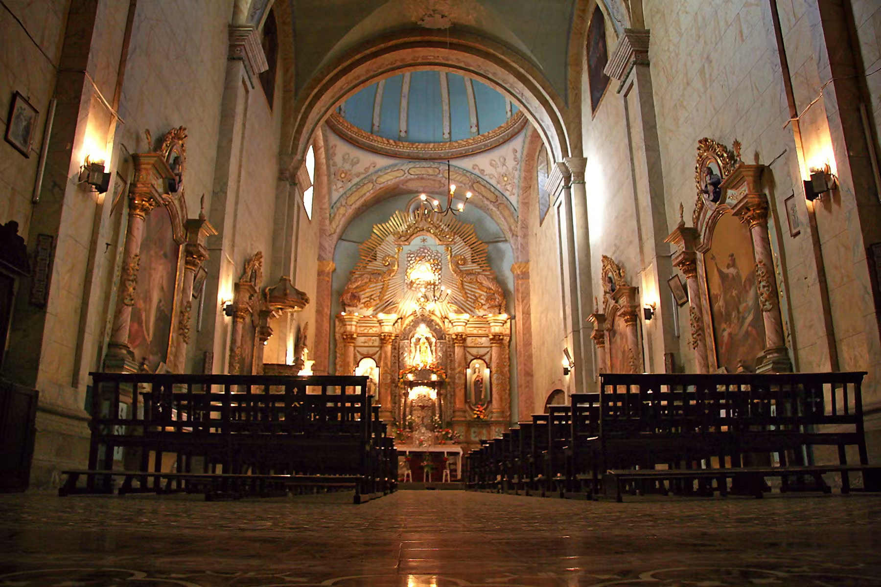
Santa Teresa Convent: Cloistered Lives Behind Colonial Walls
Enter a 1685 Carmelite convent where colonial families paid dowries to place daughters into isolation. Tours reveal chambers where nuns lived until the church reforms of the 1960s, with devotional objects and penitential instruments offering an unsettling window into three centuries of cloistered life.
Design Your Custom Trip
Tell us about your dream adventure. Our travel specialists respond within 24 hours with a personalised itinerary.
The Mountain That Built Empires
A Closer Look at Potosí

The City That Funded Empires
In 1545, an indigenous prospector named Diego Huallpa found silver on a mountain the Inca held sacred, according to legend while chasing stray llamas across its slopes. What followed transformed world history. Within decades Potosí had grown to perhaps 160,000 inhabitants, rivaling London and Paris and surpassing any city in the Americas, as Spanish colonizers drew unimaginable wealth from Cerro Rico, the Rich Mountain. More than 45,000 tons of silver flowed from these tunnels between 1556 and 1783, funding Spain’s global empire and flooding European markets with the currency that sparked the first truly global economy. The phrase vale un Potosí, worth a Potosí, entered Spanish as shorthand for incalculable riches.
The cost was catastrophic. An unknown but vast number of indigenous mitayos and enslaved Africans died in the mines under the brutal mita system of forced labor; the figure of up to eight million often repeated by guides is a contested estimate most historians regard as inflated, yet the true toll was immense. Potosí became known as the mountain that eats men, a legacy that still haunts the city. Even so, from this darkness came extraordinary culture: baroque churches with mestizo facades blending European and Andean motifs, the largest colonial mint in the Americas, and a society so rich that legend claimed one could build a silver bridge to Spain. Today the historic city is a UNESCO World Heritage Site, preserving its architectural splendor and its troubling history in equal measure.
Into the Mountain's Heart
Cerro Rico remains an active mine, now worked by cooperative miners drawing tin, zinc, and lead from tunnels that honeycomb the mountain. Tours offer an unflinching encounter with conditions that have changed little in centuries: narrow passages, choking dust, one-ton ore carts thundering down the rails, and the ever-present offerings to El Tío. This devil-like figure is said to rule the underworld, and miners believe their safety depends on keeping him satisfied with coca leaves, cigarettes, and 96-percent alcohol. Effigies of El Tío sit at mine entrances throughout the mountain, each surrounded by the remnants of bargains struck between men and a mountain that has claimed countless lives.
The experience is intense, physically demanding at altitude and emotionally confronting in its glimpse of ongoing hardship. Many miners are said to live only into their forties, often falling to silicosis from years of breathing rock dust. Yet there is also camaraderie, dark humor, and pride in carrying on traditions that reach back generations. Visiting takes both physical preparation and emotional readiness, but for those willing to engage honestly with this difficult history, the mines offer a view of human resilience found in few other places. Potosí is one of the very few places on Earth where visitors can openly buy dynamite, sold over the counter at the miners’ market as a customary gift for the workers.
Colonial Grandeur Above Ground
While the mines defined Potosí’s wealth, the city above ground shows how that wealth was spent. The Casa de la Moneda, the Royal Mint, occupies an entire city block behind meter-thick walls; the current building went up between 1759 and 1773, replacing a first mint from the 1570s, to house the machinery that turned silver into Spanish coin. When the king saw the construction bill, legend says he exclaimed that the building must be made of silver. Today the museum preserves the massive wooden cog machines once turned by mules, galleries of colonial painting including works by the mestizo master Melchor Pérez de Holguín, and the enigmatic mascarón, a grinning face hung in the courtyard in the 1850s or 1860s for reasons no one has satisfactorily explained.
Beyond the mint, Potosí’s religious architecture rivals any in South America. The Church of San Lorenzo de Carangas carries one of Bolivia’s most photographed facades, an elaborate eighteenth-century mestizo baroque portal where indigenous artisans carved mermaids, celestial symbols, and local flora alongside Christian imagery. The Santa Teresa convent, founded in 1685, offers guided tours through chambers where cloistered Carmelite nuns lived in near-total isolation until the church reforms of the 1960s, their cells and devotional objects giving an unsettling sense of colonial religious life. Throughout the historic center, more than 2,000 colonial buildings preserve the legacy of what was once the richest and most populous city in the Americas.
Explore More
Other Bolivia Destinations
Explore more destinations across Bolivia.
Barba Azul Nature Reserve
In the heart of Bolivia's Beni savanna, the Barba Azul Nature Reserve protects 12,200 hectares of seasonally flooded grassland, palm...
ExploreTarija Wine Country
In the far south of Bolivia, near the Argentine border, the city of Tarija and the surrounding valleys form the...
ExploreNoel Kempff Mercado
Spread across 1,523,446 hectares of remote northeastern Bolivia along the Brazilian border, Noel Kempff Mercado is one of South America's...
ExploreKaa-Iya National Park
Larger than Belgium and home to one of the largest jaguar populations in South America, Kaa-Iya del Gran Chaco is...
ExploreEduardo Avaroa Andean Fauna National Reserve
On Bolivia's altiplano above 4,200 meters, in the country's far southwestern corner where it meets Chile and Argentina, lies one...
ExploreSanta Cruz de la Sierra
In Bolivia's tropical lowlands, where the Andes tumble into the Amazon, Santa Cruz opens doors to landscapes found nowhere else...
ExploreAmboro National Park
At the Elbow of the Andes, where the mountains bend westward toward Peru, Amboró National Park sits at one of...
ExploreSamaipata
Around 300 CE, peoples of the Mojocoyas culture, later associated with the Chané, began sculpting a 220-meter sandstone monolith with...
ExploreSucre
Founded in 1538 as Ciudad de la Plata by Spanish colonists profiting from nearby Potosí's silver mines, Sucre grew into...
ExploreMadidi National Park
Identified by Wildlife Conservation Society researchers as probably the most biodiverse protected area on Earth, Madidi spans nearly 19,000 square...
ExploreNorth Yungas Road
Carved into sheer cliffs in the 1930s, the North Yungas Road, El Camino de la Muerte, is estimated to have...
ExploreLake Titicaca
At 3,812 meters, Lake Titicaca stretches across the Andean altiplano like a shimmering inland sea, the highest navigable lake in...
ExploreSalar de Uyuni
At 3,656 meters on the Bolivian Altiplano lies the world's largest salt flat, a 10,582-square-kilometer expanse of crystalline white that...
ExploreLa Paz
Perched between 3,250 and 4,100 meters above sea level, La Paz defies gravity and expectations as the world's highest administrative...
Explore