Contact Us

Jeti-Oguz, Kyrgyzstan

Travel to Jeti-Oguz

The Seven Bulls of the Tian Shan

Location Overview

Flag of Kyrgyzstan

Jeti-Oguz

The Seven Bulls of the Tian Shan

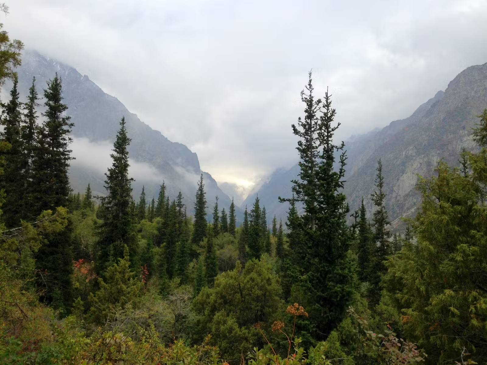
Protected as a geological monument in 1975, the Jeti-Oguz formation takes its Kyrgyz name from seven blood-red sandstone cliffs that legend says are bulls turned to stone by a khan's vengeance. At 2,200 meters on the Terskey Ala-Too range, these Tertiary red conglomerates — some reaching 400 meters high and colored by millions of years of iron oxide deposits — guard the entrance to a 37-kilometer gorge stretching toward peaks exceeding 5,000 meters. Beyond the rocks, the Kok-Jayik Valley of Flowers erupts with poppies and alpine wildflowers each spring at 2,800 meters. Burial mounds dating to the 7th century BCE line the village, the 1932 Soviet sanatorium still dispenses radon mineral treatments, and nomadic families summer their herds on the jailoo pastures above. The gorge terminates beneath Oguz Bashi peak at 5,168 meters, the mountain the Kyrgyz call the Head of the Bull.

Location

Jeti-Oguz

42.3371° / 78.2309°

Open in Google Maps

Bespoke Travel

Experience Jeti-Oguz, Your Way

Skip the standard itineraries. We design journeys around your interests, timeline, and curiosity, with access you will not find on any platform.

100%
Customizable
24hr
Response Time
1:1
Expert Planning

Experiences

Things to Do in Jeti-Oguz

Starting points for your perfect trip

Ready to create something unique?

Tell us your vision and we will make it happen

The Seven Bulls of the Tian Shan

A Closer Look at Jeti-Oguz

Where Mountains Turn to Legend

Jeti-Oguz · 01 / 03

Chapter 01 / 03

Where Mountains Turn to Legend

Jeti-Oguz announces itself with a wall of blood-red sandstone cliffs erupting from emerald alpine slopes, their color so vivid against the green that legend inevitably filled the silence. The Kyrgyz name means “Seven Bulls,” and the formations do resemble massive bovines lying in repose, their flanks turned crimson by iron oxide deposits accumulated over millions of years. The most enduring legend speaks of a khan whose wife was stolen by a rival. In vengeance, he held a seven-day feast, slaughtering a bull each day, and on the final night murdered the captive woman. Her blood swept the bulls down the valley, and where they came to rest, they turned to stone. Kyrgyz families still share this story with their children beneath the very cliffs it describes.

Just before the Seven Bulls stands another formation equally steeped in tragedy—the Broken Heart, a cleft red rock said to mark the spot where a woman died of grief after two suitors killed each other fighting for her love. These are not simply geological curiosities but living mythology woven into Kyrgyz painting, poetry, and music for centuries. The formations were protected as a nature monument in 1975, recognizing both their geological significance—the cliffs are Tertiary red conglomerates, some reaching 400 meters in height—and their cultural importance as national symbols. Burial mounds called kurgans near the village, dating from the 7th to 5th centuries BCE and measuring up to 28 meters in diameter, confirm that humans have considered this valley significant for at least 2,500 years.

Contents

From the Journal

Stories from Jeti-Oguz

Field notes, cultural encounters and trail dispatches from our guides and travellers in Jeti-Oguz.

All stories

Plan Your Journey

Best Time to Visit Jeti-Oguz

The warmest months in the gorge, with all trails fully accessible and nomadic yurt camps operating on the jailoo pastures above the valley. Daytime temperatures reach 20–23°C at the resort elevation, though nights cool sharply. Late wildflower blooms persist in the Valley of Flowers, and herding families welcome visitors to their summer camps. The Telety Pass route to the Karakol Valley is reliably snow-free. This is peak season for both domestic and international visitors — the Seven Bulls viewpoint and Kok-Jayik meadows see their highest traffic. Horseback expeditions to remote alpine lakes operate on full schedules.

Annual Overview

Jeti-Oguz has a continental mountain climate at 2,200 meters elevation with warm summers reaching 74°F at the valley base, cold winters dropping well below freezing, and most rainfall concentrated in the July–August period.

Month by month conditions in Jeti-Oguz
Jan Shoulder Feb Shoulder Mar Shoulder Apr Shoulder May Great Jun Great Jul Peak Aug Peak Sep Good Oct Good Nov Shoulder Dec Shoulder
24° 28° 41° 55° 63° 70° 74° 73° 65° 52° 38° 27°
  • Peak
  • Great
  • Good
  • Shoulder
  • Off-season

Travel Logistics

Getting to Jeti-Oguz

Choose your route. Every option arrives at the same place.

Drive from Karakol

Journey Time
30-45 minutes
Approximate Cost
From 100 som marshrutka

Just 28 kilometers southwest of Karakol on a paved road, Jeti-Oguz is easily accessible by marshrutka #372 from Karakol's Ak-Tilek Bazaar to the Jeti-Oguz resort. Confirm your driver continues to 'Jeti-Oguz Kurort' rather than the village of the same name located 15 kilometers before the resort.

  • Drive from Karakol

    Just 28 kilometers southwest of Karakol on a paved road, Jeti-Oguz is easily accessible by marshrutka #372 from Karakol's Ak-Tilek Bazaar to the Jeti-Oguz resort. Confirm your driver continues to 'Jeti-Oguz Kurort' rather than…

    Approximate Cost
    From 100 som marshrutka
  • Day Trip from Bishkek

    The 400-kilometer journey from Bishkek to Karakol follows the scenic Issyk-Kul northern shore. Marshrutkas depart from Bishkek's Avtovokzal throughout the day, taking approximately 6 hours. The GoBus coach service offers comfortable scheduled departures. From…

    Approximate Cost
    From 500 som bus / $50-80 private hire
  • Telety Pass Trek from Karakol Valley

    The Telety Pass route connects Jeti-Oguz to the Karakol Valley via a spectacular 3,820-meter crossing through the Terskey Ala-Too range. Trekkers typically start from the Karakol Valley, summit Ala-Kul Lake at 3,532 meters, cross…

    Approximate Cost
    Yurt camp costs only

Why Travel with Us

Travel with EcoVoyager

Jeti-Oguz sits 28 kilometers southwest of Karakol on a paved road, where the Terskey Ala-Too's most famous red sandstone formations guard a 37-kilometer gorge leading toward 5,000-meter peaks. EcoVoyager connects you with historian-guides who bring the Seven Bulls legends and 2,500 years of kurgan burial history to life, naturalists who identify alpine wildflower species in the Kok-Jayik meadows, and horseback expedition leaders who navigate routes to remote lakes inaccessible by foot. Our local partners arrange nomadic yurt stays on the summer jailoo, Soviet-era sanatorium treatments, and multi-day treks crossing the 3,820-meter Telety Pass to connect with the Ala-Kul circuit.

  • Historian-guided Seven Bulls geology and legend walks
  • Naturalist-led wildflower identification in the Valley of Flowers
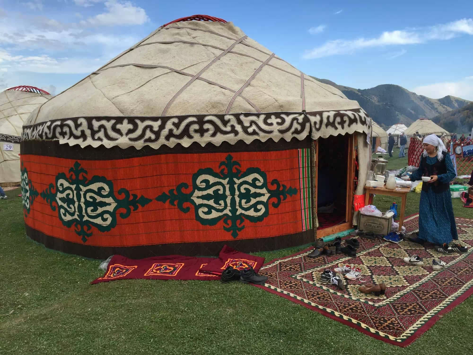
  • Nomadic-hosted jailoo yurt stays with traditional Kyrgyz meals
  • Horseback-led expeditions to remote alpine lakes above 3,000 meters

Keep Exploring

Other Kyrgyzstan Destinations

Locations

1 / 15

Ala Archa National Park

Rising from 1,500 to 4,895 meters just 40 kilometers south of Bishkek, Ala Archa National Park compresses the full drama of the Tien Shan into a single spectacular valley. Established in 1976, this 200-square-kilometer…

Ala Archa National Park in Kyrgyzstan

Ala Archa National Park, Kyrgyzstan

Ala Archa National Park

Rising from 1,500 to 4,895 meters just 40 kilometers south of Bishkek, Ala Archa National Park compresses the full drama of the Tien Shan into a single spectacular valley. Established in 1976, this 200-square-kilometer…

Ala-Kul Lake in Kyrgyzstan

Ala-Kul Lake, Kyrgyzstan

Ala-Kul Lake

First documented by Russian explorer Putimtsoff in 1811, Ala-Kul earned its Kyrgyz name — "Motley Lake" — from surface waters that shift between turquoise, purple, and gold with changing light. At 3,532 meters in…

Arslanbob in Kyrgyzstan

Arslanbob, Kyrgyzstan

Arslanbob

Named for a revered 11th-century Sufi leader who reportedly founded the settlement around 1120 CE, Arslanbob sits at 1,500 meters in the Babash-Ata Mountains of southern Kyrgyzstan, sheltering the largest natural walnut forest on…

Bishkek in Kyrgyzstan

Bishkek, Kyrgyzstan

Bishkek

Sprawling at 800 meters across the Chuy Valley beneath the snow-capped Kyrgyz Ala-Too range, Bishkek is Central Asia's greenest capital—a city where Soviet modernist architecture and leafy poplar boulevards give way to dramatic alpine…

Burana Tower in Kyrgyzstan

Burana Tower, Kyrgyzstan

Burana Tower

Rising from the Chuy Valley 80 kilometers east of Bishkek, the 11th-century Burana Tower is the sole surviving monument of Balasagun, a Karakhanid capital that once sprawled across 25 to 30 square kilometers. Built…

Issyk-Kul Lake in Kyrgyzstan

Issyk-Kul, Kyrgyzstan

Issyk-Kul Lake

At 1,607 meters in the Tian Shan mountains, Issyk-Kul stretches 182 kilometers across—the world's second-largest alpine lake after Titicaca. Its name means 'warm lake' in Kyrgyz because the mineral-rich waters never freeze, even when…

Jyrgalan Valley in Kyrgyzstan

Jyrgalan, Kyrgyzstan

Jyrgalan Valley

At 2,200 meters in the eastern Tien Shan, Jyrgalan has transformed from a dying Soviet coal town into Kyrgyzstan's most exciting ecotourism success story. Seven peaks of the Terskey Ala-Too Range ring this remote…

Karakol in Kyrgyzstan

Karakol, Kyrgyzstan

Karakol

At 1,770 meters near Issyk-Kul’s eastern tip, Karakol has evolved from an 1869 Russian military outpost into Kyrgyzstan’s adventure capital and fourth-largest city. This multicultural hub serves as the gateway to Central Asia’s most…

Naryn Oblast, Kyrgyzstan

Kel Suu Lake

Kel Suu is a canyon lake at 3,514 m (11,529 ft) in the Kok-Kiya Valley, At-Bashi district, Naryn Oblast—formed when a landslide dammed the Kurumduk River in the Kokshaal-Too range of the Tian Shan,…

Osh in Kyrgyzstan

Osh, Kyrgyzstan

Osh

At 1,000 meters where the Fergana Valley meets the Pamir-Alay foothills, Osh has anchored Silk Road trade for over 3,000 years. Kyrgyzstan’s oldest and second-largest city rises around Sulaiman-Too—a sacred limestone mountain drawing pilgrims…

Peak Lenin Base Camp in Kyrgyzstan

Peak Lenin Base Camp, Kyrgyzstan

Peak Lenin Base Camp

At 3,600 meters in the Achik-Tash Valley, Base Camp sits beneath 7,134-meter Peak Lenin, the most frequently summited 7,000-meter peak on Earth and a cornerstone of Central Asian mountaineering since the first ascent in…

Sary-Chelek Biosphere Reserve in Kyrgyzstan

Sary-Chelek, Kyrgyzstan

Sary-Chelek Biosphere Reserve

At 1,880 meters in Kyrgyzstan's western Tien Shan, Sary-Chelek Lake lies cradled by ancient walnut forests in one of Central Asia's most biodiverse corners. This UNESCO Biosphere Reserve formed roughly 10,000 years ago when…

Skazka Canyon in Kyrgyzstan

Skazka Canyon, Kyrgyzstan

Skazka Canyon

On the southern shore of Issyk-Kul, Central Asia’s largest alpine lake, wind and water have sculpted Neogene-era sediments into a landscape that defies imagination. Skazka—Russian for fairytale—earns its name through surreal formations in vivid…

Song-Kul Lake in Kyrgyzstan

Jewel of the Jailoos

Song-Kul Lake

At 3,016 meters in the Inner Tian Shan, Song-Kul is Kyrgyzstan's second-largest lake and its largest freshwater body, a 270-square-kilometer alpine expanse draining through a single outlet into the Naryn, Central Asia's greatest river.…

Tash Rabat in Kyrgyzstan

Tash Rabat, Kyrgyzstan

Tash Rabat

At 3,200 meters in the remote Kara-Koyun gorge of Kyrgyzstan’s Inner Tien Shan, Tash Rabat emerges from a mountainside like a vision from another age. This 15th-century stone caravanserai, first documented by Kazakh explorer…